Trail Walking Les Ormes - les Ormes - GR48 GR655 Poizay PM - 9.4km 100m 2h05 - 2024 07 18 - Photo

les Ormes - GR48 GR655 Poizay PM - 9.4km 100m 2h05 - 2024 07 18

 Orcal37
Orcal37

User GUIDE

© OpenStreetMap contributors
Length
Length
9.4 km
Max alt
Max alt
115 m
Uphill gradient
Uphill gradient
101 m
Km-Effort
Km-Effort  
10.7 km
Min alt
Min alt
46 m
Downhill gradient
Downhill gradient
100 m
Boucle
Boucle
Yes
Creation date :
2024-07-18 12:57:46.659
Updated on :
2024-09-13 20:20:13.078

(0 Reviews)

Walking
Walking
2h05
Difficulty : Easy

Scan this QR Code to open this trail in the SityTrail application

FREE GPS app for hiking

Logo SityTrail SityTrail

IGN / Geographical institutes

Download SityTrail from the App Store Download SityTrail from Google Play

Logo SityTrail SityTrail World

The world is yours!

Download SityTrail from the App Store Download SityTrail from Google Play Download SityTrail on Huawei AppGallery

About

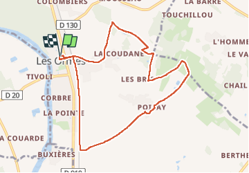
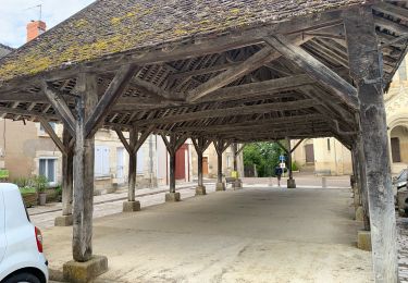
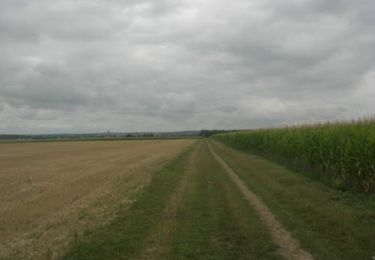
Trail Walking of 9.4 km to be discovered at New Aquitaine, Vienne, Les Ormes. This trail is proposed by Orcal37.

Description

les Ormes - GR48 GR655 - PR chemins - Poizay - GR655 - 9.4km 100m 2h05 - 2024 07 18

Elevation profile

Photos

Positioning

Country:
France
Region :
New Aquitaine
Department/Province :
Vienne
Municipality :
Les Ormes
Location:
Unknown
Start:(UTM)
317789 ; 5205035 (31T) N.

Trails nearby

Trail Walking Port-de-Piles - Port-de-Piles - la Creuse les Ormes GR655 - 20.7km 300m 4h30 (1h) - 2024 09 13 - Photo
Walking
GUIDE
Orcal37

Walking

Medium
Port-de-Piles, New Aquitaine, Vienne, France
20 km | 24 km-effort
4h 30min
Yes
Trail Walking Antogny-le-Tillac - Antogny-le-Tillac - GR48 les Ormes AM - 17.4km 180m 3h50 (45mn) - 2024 07 18 - Photo
Walking
GUIDE
Orcal37

Walking

Easy
Antogny-le-Tillac, Centre-Loire Valley, Indre-et-Loire, France
17.3 km | 19.7 km-effort
3h 50min
Yes
Trail Walking Port-de-Piles - Port-de-Piles - GR655 GR48 Descartes GRP Touraine Sud - 25.6km 180m 5h30 (45mn) - 2024 04 20 - Photo
Walking
GUIDE
Orcal37

Walking

Easy
Port-de-Piles, New Aquitaine, Vienne, France
26 km | 29 km-effort
5h 30min
Yes
Trail Walking Ports-sur-Vienne - Ports-sur-Vienne - GR48 Pussigny Ponçay - 23.4km 410m 5h15 (50mn) - 2024 04 13 - Photo
Walking
GUIDE
Orcal37

Walking

Medium
Ports-sur-Vienne, Centre-Loire Valley, Indre-et-Loire, France
24 km | 29 km-effort
5h 15min
Yes
Trail Walking Dangé-Saint-Romain - JFT YB Etape4 30-4-2014 - Photo
Walking
jeff2

Walking

Very easy
Dangé-Saint-Romain, New Aquitaine, Vienne, France
32 km | 34 km-effort
7h 30min
No
Trail Walking La Celle-Saint-Avant - Voie de Tours - 9ème étape :La Celle Saint-Avant - Chatellerault - Photo
Walking
LEGUE

Walking

Medium
La Celle-Saint-Avant, Centre-Loire Valley, Indre-et-Loire, France
26 km | 28 km-effort
4h 53min
No
Trail Mountain bike La Celle-Saint-Avant - Rando VTT La Celle St Avant - Sept 2011 - Photo
Mountain bike
tracegps

Mountain bike

Medium
La Celle-Saint-Avant, Centre-Loire Valley, Indre-et-Loire, France
28 km | 31 km-effort
1h 40min
Yes
Trail Running Dangé-Saint-Romain - Autour déchèterie - Photo
Running
pabi86

Running

Dangé-Saint-Romain, New Aquitaine, Vienne, France
4.6 km | 5 km-effort
33min
Yes
Trail Running Dangé-Saint-Romain - 13-2 - Photo
Running
pabi86

Running

Dangé-Saint-Romain, New Aquitaine, Vienne, France
5 km | 5.5 km-effort
40min
Yes


Close
My subscriptions